Superblock Cuenca
Project Overview
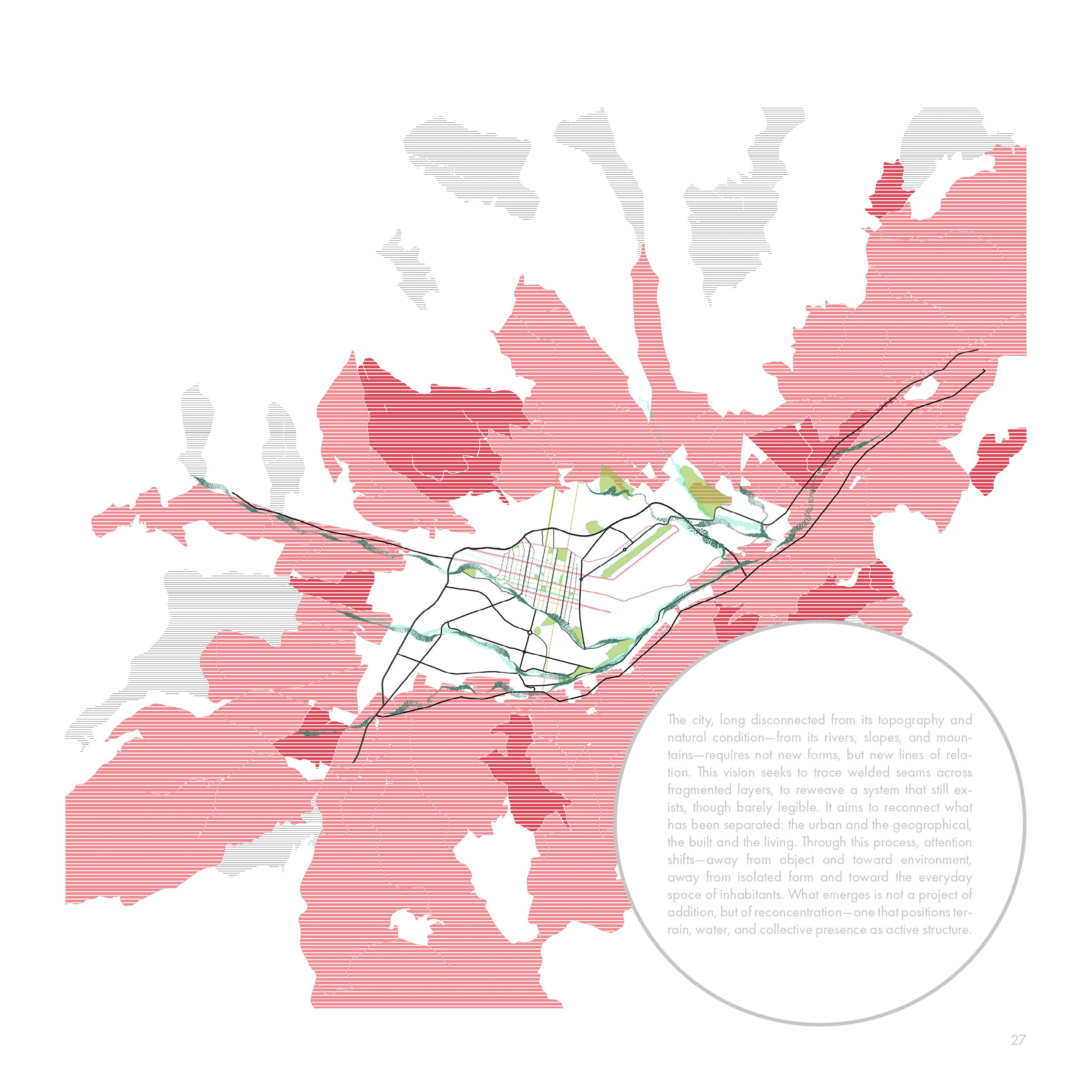
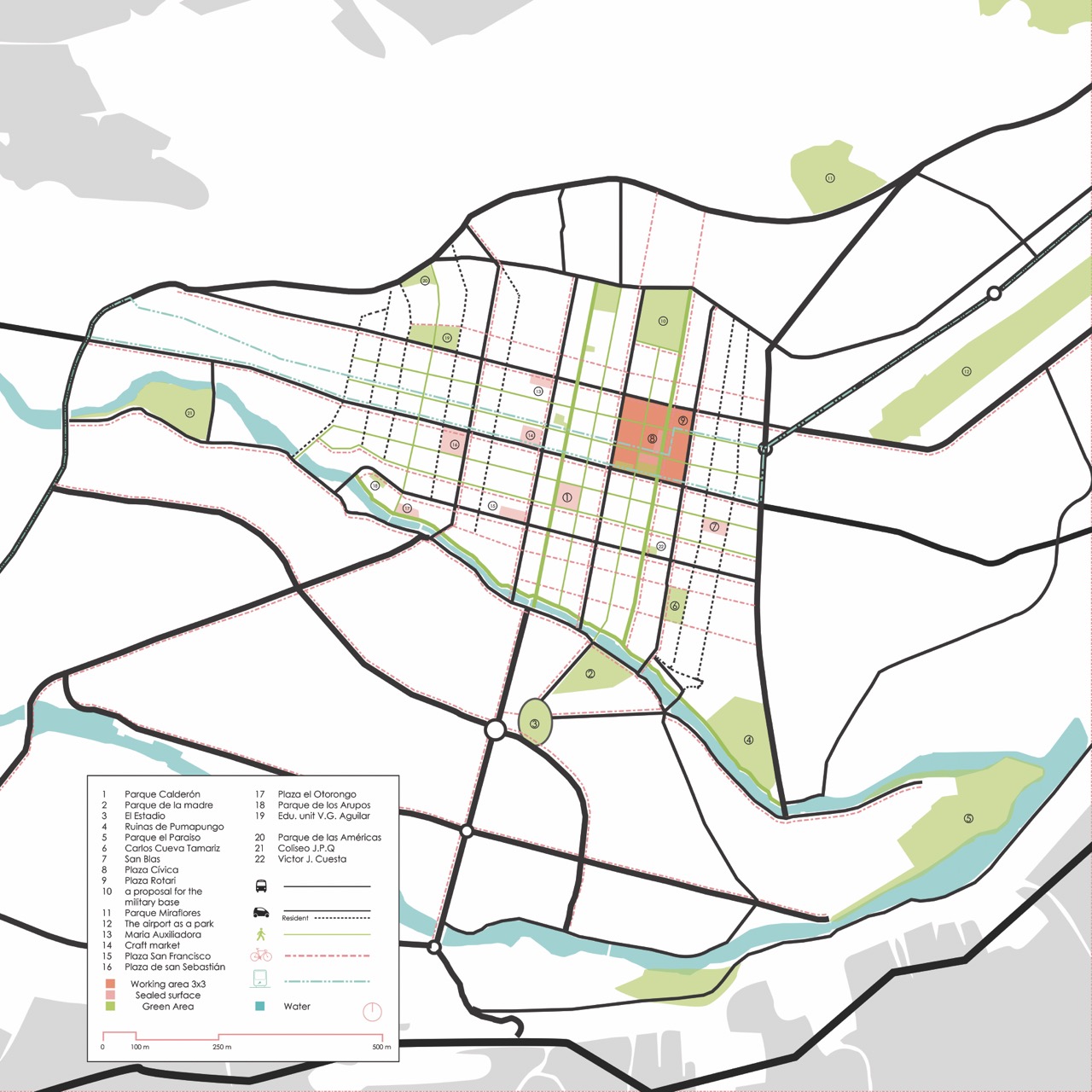
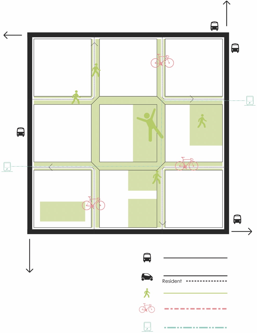
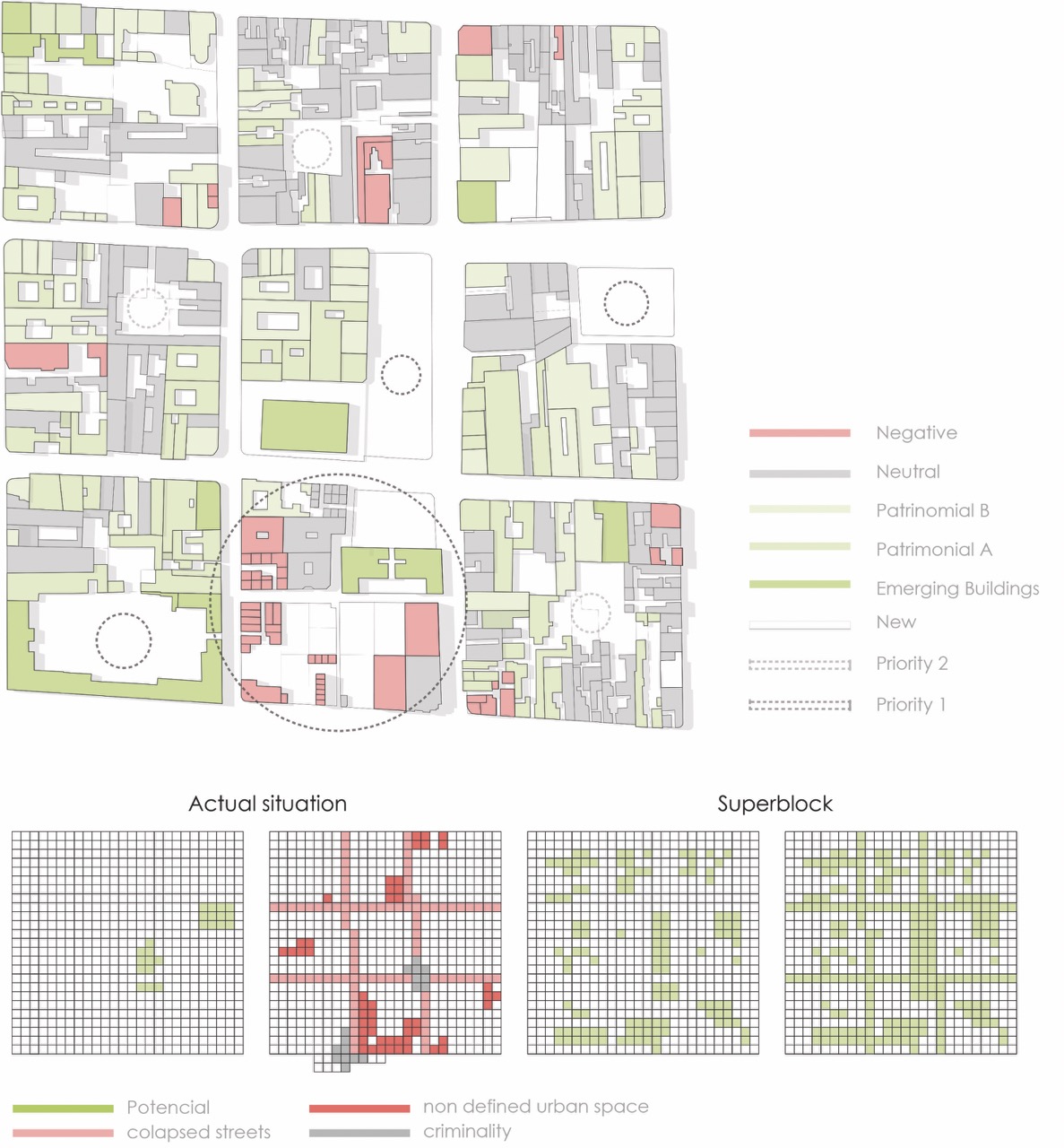
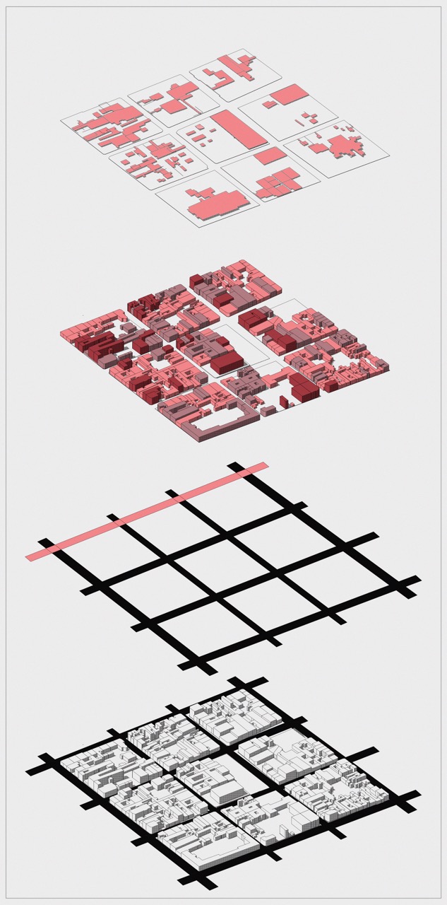
A historic center. Cars everywhere. Streets belong to traffic. But the center belongs to people. We take back the streets. Move cars to the edges. Open the interior for walking. For cycling. For gathering. For markets. For children. For trees. The streets become linear parks. Connected corridors. The center becomes a network of plazas and streets that breathe together. No single center. Many centers. Each block is a community. Connected. The river moves through it all.
- Typology: Urban design, public space, mobility strategy
- Location: Cuenca, Ecuador — Historic Centre
- Status: Research & strategic design proposal
Design Principles
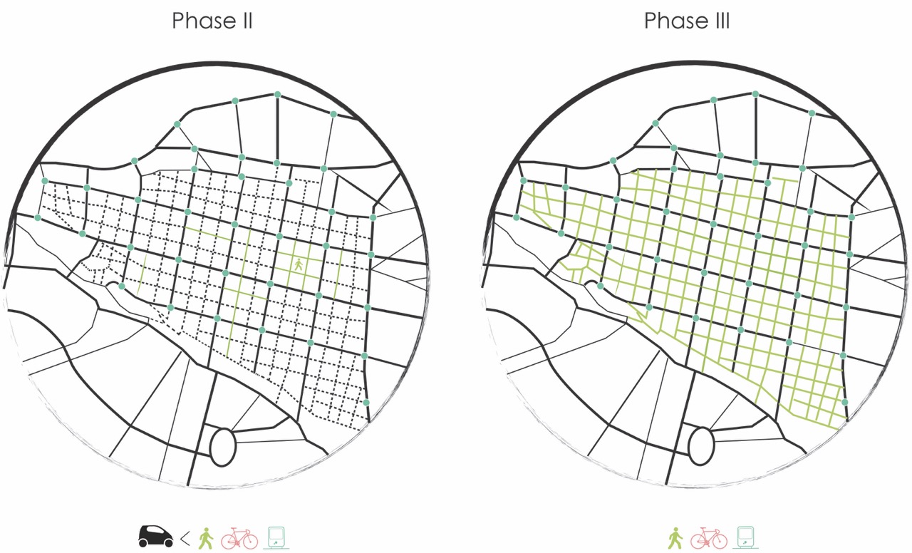
Mobility Hierarchy
Traffic is re-routed to the edges while interior streets become shared surfaces prioritising pedestrians, cyclists, and micro-mobility. Service vehicles operate during limited windows to minimise conflicts.
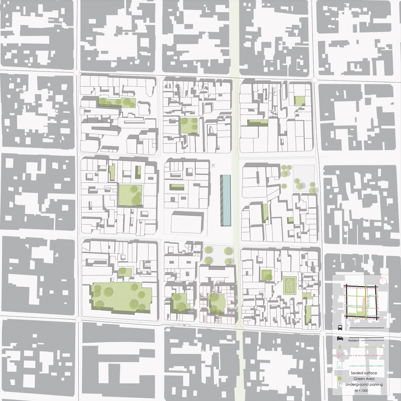
Ecological Corridors
Linear parks and planted streets stitch together existing green pockets, improving biodiversity, storm-water management, and thermal comfort while connecting to the Tomebamba river landscape.
Civic Nodes
Plazas, school yards, and market forecourts are reprogrammed as active nodes that support community-led events, cultural programming, and everyday social life across the superblock network.

Credits
Proyectual Studio